Write a location to search
    Close
    Advertise Favorites
    Login
    Filter
    Filter
    Close
    Order
    For
    Buy
    Rent
    Price
    Bedrooms
    0 0
    1 1
    2 2
    3 3
    4+ 4 or +
    Area
    Features
    Publication Date

    14 Realestates for sale "del rei na charneca" until 375.000 €, in Setúbal older

    18
    IMG_5439

    Garage in Almada, Cova da Piedade, Pragal e Cacilhas

    Almada, Cova da Piedade, Pragal e Cacilhas, Almada, Setúbal
    2 bathrooms
    485 m²
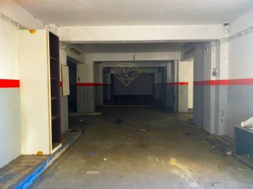
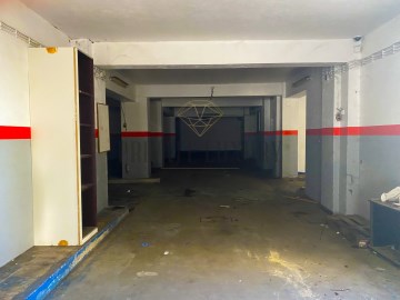
    Almada Garage, 485m2 Garage with excellent areas in the neighborhood of Barrocas in Almada. Great deal! Almada is a Portuguese city located in the Lisbon Metropolitan Area. It has an urban area of 13.98 km2 and 88,202 inhabitants in 2021, hence a population density of 6,309 inhabitants per km2, being the 10th largest city in the country. It is the seat of the municipality of Almada, which has an extension of 70.21 km2 and 177,400 inhabitants in 2021, with a population density of 2,525 inhabitants per km2, divided into five parishes. The municipality is bordered to the east by the municipality of Seixal, to the south by the municipality of Sesimbra, to the west by the Atlantic Ocean and to the north by the Tagus Estuary. The municipality received a charter from Dom Sancho I in 1190. Together with Lisbon, Sintra and Palmela, it is one of the oldest administrative divisions of the Lisbon Metropolitan Area. Almada was elevated to the category of city in 1973, and in its municipality is also the city of Costa da Caparica, whose current status was granted to it in 2004. It has as its main point of interest the National Sanctuary of Christ the King. Geography The municipality of Almada is located in the north-western quadrant of the Setúbal Peninsula. This has as limits, to the north, the Tagus Bottleneck; to the southeast, the municipality of Seixal; and to the south, the municipality of Sesimbra. Its westernmost point is in Cova do Vapor and the easternmost in the Lisbon Naval Base, next to the Corroios Marshland. Cacilhas is the northernmost town of the county, while the southernmost point is in the area of Adiça. The highest point of the county, in the Raposo area, rises in 124.4 m. As for its relief, the municipality is divided into two main areas: the applanation surface (part of the Belverde platform) and the coastal planation. The applanation surface comprises the areas between Trafaria, Almada, Pragal and Caparica up to the ridge line between Sobreda and Charneca, being delimited by the Fossil Cliff of Costa de Caparica and by the escarpments that confront and accompany the Tagus Bottleneck and the municipalities of the north bank of the river (the riverside coasts, one of its main elements of the landscape). In it, the terrain is more undulating to the northeast, moderating its roughness towards the southwest. The quota also decreases to the south and to the interior of the county (where the 60 to 80 m of quota is reached), and this trend is interrupted by the line of summits Lazarim-Capuchos (whose maximum heights are from 90 to 100 m). The source, towards the Sea of Straw, its elevations also descend until they reach maximums of 30 to 40 m. In turn, these escarpments are torn by ditches created by the drainage lines that will flow into the Tagus. The second corresponds to the coastal plain of Costa de Caparica, which does not exceed 11 meters of altimetric level. It has a greater width to the north, gradually constricting towards the south. The east, is bounded longitudinally by the Fossil Cliff of Costa de Caparica, which also decreases in altitude towards meridião. The interstice between the highest areas of the municipality is filled by a depressionary zone marked by the main water lines of the territory of Almada. The highest slopes are found in the two cliffs already mentioned. In the Northern Riverfront (on the slopes of Arealva, Cristo Rei, Banática, Montalvão and Porto do Buxo) the slopes exceed 50%. On the reverse of these, the slopes are moderately abrupt and have slopes between 5% and 16%. Between Cacilhas, Margueira and Cova da Piedade there is a flat strip with slopes of less than 5%, thanks to the alluvial features of the Vala do Caramujo and the embankments built there. The Fossil Cliff has slopes generally greater than 25%, with sections where these exceed 50% and with an almost vertical profile to the north. At its foothills, the coastal plain has a maximum slope of 12%, higher than south of Foz do Rego due to the existence of dunes. The southern part of the coastal platform (Aroeira) has insignificant slopes. To the interior (already on the applanation surface, in a strip between Cacilhas, Pragal, Costas de Cão, Murfacém and Palhais) the slopes present there have slopes of very diverse slopes but ranging from medium to sharp (between 5% and 16%). #ref:8053
    240.000 €
    30+ days ago supercasa.pt
    View property
    9
    STORE FOR RESTORATION Caparica Heath
    18
    IMG_5439

    Garage in Almada, Cova da Piedade, Pragal e Cacilhas

    Almada, Cova da Piedade, Pragal e Cacilhas, Almada, Setúbal
    2 bathrooms
    485 m²
    Almada Garage, 485m2 Garage with excellent areas in the neighborhood of Barrocas in Almada. Great deal! Almada is a Portuguese city located in the Lisbon Metropolitan Area. It has an urban area of 13.98 km2 and 88,202 inhabitants in 2021, hence a population density of 6,309 inhabitants per km2, being the 10th largest city in the country. It is the seat of the municipality of Almada, which has an extension of 70.21 km2 and 177,400 inhabitants in 2021, with a population density of 2,525 inhabitants per km2, divided into five parishes. The municipality is bordered to the east by the municipality of Seixal, to the south by the municipality of Sesimbra, to the west by the Atlantic Ocean and to the north by the Tagus Estuary. The municipality received a charter from Dom Sancho I in 1190. Together with Lisbon, Sintra and Palmela, it is one of the oldest administrative divisions of the Lisbon Metropolitan Area. Almada was elevated to the category of city in 1973, and in its municipality is also the city of Costa da Caparica, whose current status was granted to it in 2004. It has as its main point of interest the National Sanctuary of Christ the King. Geography The municipality of Almada is located in the north-western quadrant of the Setúbal Peninsula. This has as limits, to the north, the Tagus Bottleneck; to the southeast, the municipality of Seixal; and to the south, the municipality of Sesimbra. Its westernmost point is in Cova do Vapor and the easternmost in the Lisbon Naval Base, next to the Corroios Marshland. Cacilhas is the northernmost town of the county, while the southernmost point is in the area of Adiça. The highest point of the county, in the Raposo area, rises in 124.4 m. As for its relief, the municipality is divided into two main areas: the applanation surface (part of the Belverde platform) and the coastal planation. The applanation surface comprises the areas between Trafaria, Almada, Pragal and Caparica up to the ridge line between Sobreda and Charneca, being delimited by the Fossil Cliff of Costa de Caparica and by the escarpments that confront and accompany the Tagus Bottleneck and the municipalities of the north bank of the river (the riverside coasts, one of its main elements of the landscape). In it, the terrain is more undulating to the northeast, moderating its roughness towards the southwest. The quota also decreases to the south and to the interior of the county (where the 60 to 80 m of quota is reached), and this trend is interrupted by the line of summits Lazarim-Capuchos (whose maximum heights are from 90 to 100 m). The source, towards the Sea of Straw, its elevations also descend until they reach maximums of 30 to 40 m. In turn, these escarpments are torn by ditches created by the drainage lines that will flow into the Tagus. The second corresponds to the coastal plain of Costa de Caparica, which does not exceed 11 meters of altimetric level. It has a greater width to the north, gradually constricting towards the south. The east, is bounded longitudinally by the Fossil Cliff of Costa de Caparica, which also decreases in altitude towards meridião. The interstice between the highest areas of the municipality is filled by a depressionary zone marked by the main water lines of the territory of Almada. The highest slopes are found in the two cliffs already mentioned. In the Northern Riverfront (on the slopes of Arealva, Cristo Rei, Banática, Montalvão and Porto do Buxo) the slopes exceed 50%. On the reverse of these, the slopes are moderately abrupt and have slopes between 5% and 16%. Between Cacilhas, Margueira and Cova da Piedade there is a flat strip with slopes of less than 5%, thanks to the alluvial features of the Vala do Caramujo and the embankments built there. The Fossil Cliff has slopes generally greater than 25%, with sections where these exceed 50% and with an almost vertical profile to the north. At its foothills, the coastal plain has a maximum slope of 12%, higher than south of Foz do Rego due to the existence of dunes. The southern part of the coastal platform (Aroeira) has insignificant slopes. To the interior (already on the applanation surface, in a strip between Cacilhas, Pragal, Costas de Cão, Murfacém and Palhais) the slopes present there have slopes of very diverse slopes but ranging from medium to sharp (between 5% and 16%). #ref:8053
    240.000 €
    30+ days ago casa.sapo.pt
    View property
    32
    Piscina condominio

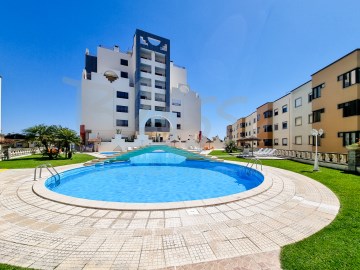
    Apartment 3 Bedrooms in Charneca de Caparica e Sobreda

    Charneca de Caparica e Sobreda, Almada, Setúbal
    3 bedrooms
    2 bathrooms
    99 m²
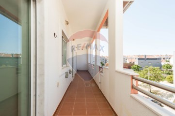
    Welcome to this magnificent 3 bedroom flat, transformed into 2+1 bedrooms, inserted in a condominium with swimming pool, located approximately 10 minutes from Praia do Rei, in Costa da Caparica, which offers a unique opportunity to live in a privileged area of Charneca da Caparica. The flat, refurbished with sophistication and good taste with modern and quality materials, consists of a fully equipped kitchen with hob and oven, washing machines and AEG dishes, fridge, extractor fan and water heater, 2 bedrooms, one of them en suite and with wardrobe, bathroom with shower and a living room with balcony. With armoured door and alarm, which guarantee the security of the entrance to the flat, while the PVC window frames with double glazing offer good thermal and acoustic insulation, with electric shutters, making the environment more pleasant, with the floor being all in high quality vinyl floating floor. Inserted in the prestigious 'Del Rey Condominium', in Charneca da Caparica, where the whole family can enjoy the generous swimming pool (with a lifeguard in the summer period) and a surrounding area with outdoor space and support bar, constituting an added value on hot summer days, it also has a garage with parking space and storage. With a contemporary design and an excellent distribution of space, this flat is ideal for those looking for comfort and quality of life, being located on the ground floor of a building with lift. Charneca da Caparica is located in a privileged area, very close to the beaches of Costa da Caparica and the centre of Lisbon through the 25 de Abril Bridge. In a central area, with all the main needs nearby, schools, restaurants and services, with easy access to Lisbon by the A33, 10 minutes from the 25 de Abril Bridge and close to all kinds of shops, transport and international schools. Feel like you're on holiday all year round. It is a perfect alternative for those who want to live on the outskirts of the capital, with an unprecedented quality of life. Are you convinced? Come and visit! BL 114769 #ref:BL114769 - 477/2024
    356.500 €
    30+ days ago casa.sapo.pt
    View property
    9
    STORE FOR RESTORATION Caparica Heath
    18
    IMG_5439

    Garage in Almada, Cova da Piedade, Pragal e Cacilhas

    Almada, Cova da Piedade, Pragal e Cacilhas, Almada, Setúbal
    2 bathrooms
    485 m²
    Almada Garage, 485m2 Garage with excellent areas in the neighborhood of Barrocas in Almada. Great deal! Almada is a Portuguese city located in the Lisbon Metropolitan Area. It has an urban area of 13.98 km2 and 88,202 inhabitants in 2021, hence a population density of 6,309 inhabitants per km2, being the 10th largest city in the country. It is the seat of the municipality of Almada, which has an extension of 70.21 km2 and 177,400 inhabitants in 2021, with a population density of 2,525 inhabitants per km2, divided into five parishes. The municipality is bordered to the east by the municipality of Seixal, to the south by the municipality of Sesimbra, to the west by the Atlantic Ocean and to the north by the Tagus Estuary. The municipality received a charter from Dom Sancho I in 1190. Together with Lisbon, Sintra and Palmela, it is one of the oldest administrative divisions of the Lisbon Metropolitan Area. Almada was elevated to the category of city in 1973, and in its municipality is also the city of Costa da Caparica, whose current status was granted to it in 2004. It has as its main point of interest the National Sanctuary of Christ the King. Geography The municipality of Almada is located in the north-western quadrant of the Setúbal Peninsula. This has as limits, to the north, the Tagus Bottleneck; to the southeast, the municipality of Seixal; and to the south, the municipality of Sesimbra. Its westernmost point is in Cova do Vapor and the easternmost in the Lisbon Naval Base, next to the Corroios Marshland. Cacilhas is the northernmost town of the county, while the southernmost point is in the area of Adiça. The highest point of the county, in the Raposo area, rises in 124.4 m. As for its relief, the municipality is divided into two main areas: the applanation surface (part of the Belverde platform) and the coastal planation. The applanation surface comprises the areas between Trafaria, Almada, Pragal and Caparica up to the ridge line between Sobreda and Charneca, being delimited by the Fossil Cliff of Costa de Caparica and by the escarpments that confront and accompany the Tagus Bottleneck and the municipalities of the north bank of the river (the riverside coasts, one of its main elements of the landscape). In it, the terrain is more undulating to the northeast, moderating its roughness towards the southwest. The quota also decreases to the south and to the interior of the county (where the 60 to 80 m of quota is reached), and this trend is interrupted by the line of summits Lazarim-Capuchos (whose maximum heights are from 90 to 100 m). The source, towards the Sea of Straw, its elevations also descend until they reach maximums of 30 to 40 m. In turn, these escarpments are torn by ditches created by the drainage lines that will flow into the Tagus. The second corresponds to the coastal plain of Costa de Caparica, which does not exceed 11 meters of altimetric level. It has a greater width to the north, gradually constricting towards the south. The east, is bounded longitudinally by the Fossil Cliff of Costa de Caparica, which also decreases in altitude towards meridião. The interstice between the highest areas of the municipality is filled by a depressionary zone marked by the main water lines of the territory of Almada. The highest slopes are found in the two cliffs already mentioned. In the Northern Riverfront (on the slopes of Arealva, Cristo Rei, Banática, Montalvão and Porto do Buxo) the slopes exceed 50%. On the reverse of these, the slopes are moderately abrupt and have slopes between 5% and 16%. Between Cacilhas, Margueira and Cova da Piedade there is a flat strip with slopes of less than 5%, thanks to the alluvial features of the Vala do Caramujo and the embankments built there. The Fossil Cliff has slopes generally greater than 25%, with sections where these exceed 50% and with an almost vertical profile to the north. At its foothills, the coastal plain has a maximum slope of 12%, higher than south of Foz do Rego due to the existence of dunes. The southern part of the coastal platform (Aroeira) has insignificant slopes. To the interior (already on the applanation surface, in a strip between Cacilhas, Pragal, Costas de Cão, Murfacém and Palhais) the slopes present there have slopes of very diverse slopes but ranging from medium to sharp (between 5% and 16%). #ref:8053
    240.000 €
    30+ days ago casa.sapo.pt
    View property
    20
    Apartment 2 Bedrooms in Charneca de Caparica e Sobreda
    15
    Garage in Almada, Cova da Piedade, Pragal e Cacilhas

    Garage in Almada, Cova da Piedade, Pragal e Cacilhas

    Almada, Cova da Piedade, Pragal e Cacilhas, Almada, Setúbal
    2 bathrooms
    Garagem Almada, 485m2 Garagem com excelentes áreas no bairro das Barrocas em Almada. Ótimo negocio! Almada é uma cidade portuguesa localizada na Área Metropolitana de Lisboa. Tem uma área urbana de 13,98 km2 e 88.202 habitantes em 2021, donde uma densidade populacional de 6.309 habitantes por km2, sendo a 10 maior cidade do país. É sede do município de Almada, que tem uma extensão de 70,21 km2 e 177.400 habitantes em 2021, com uma densidade populacional de 2.525 habitantes por km2, dividindo-se em cinco freguesias. O município é limitado a leste pelo município do Seixal, a sul pelo município de Sesimbra, a oeste pelo Oceano Atlântico e a norte pelo Estuário do Tejo. O município recebeu foral de Dom Sancho I em 1190. Juntamente com Lisboa, Sintra e Palmela, é uma das mais antigas divisões administrativas da Área Metropolitana de Lisboa. Almada foi elevada à categoria de cidade em 1973, e no seu município encontra-se também a cidade de Costa da Caparica, cujo estatuto atual lhe foi outorgado no ano de 2004. Possui como principal ponto de interesse o Santuário Nacional de Cristo Rei. Geografia O município de Almada encontra-se no quadrante norte-ocidental da Península de Setúbal. Este tem como limites, a norte, o Gargalo do Tejo; a sudeste, o concelho do Seixal; e a sul, o concelho de Sesimbra. O seu ponto mais ocidental encontra-se na Cova do Vapor e o mais oriental na Base Naval de Lisboa, junto ao Sapal de Corroios. Cacilhas é a localidade mais setentrional do concelho, enquanto que o ponto mais meridional se encontra na zona da Adiça. O ponto mais alto do concelho, na zona do Raposo, eleva-se em 124,4 m. Quanto ao seu relevo, o concelho divide-se em duas áreas principais: a superfície de aplanação (parte da plataforma de Belverde) e a aplanação litoral. A superfície de aplanação compreende as zonas entre Trafaria, Almada, Pragal e Caparica até à linha de cumeadas entre a Sobreda e Charneca, sendo delimitada pela Arriba Fóssil da Costa de Caparica e pelas escarpas que confrontam e acompanham o Gargalo do Tejo e os municípios da margem norte do rio (as costeiras ribeirinhas, um dos seus principais elementos da paisagem). Nela, o terreno apresenta-se mais ondulado a nordeste, moderando a sua rugosidade em direção a sudoeste. A cota também decresce para sul e para o interior do concelho (onde se atingem os 60 a 80 m de cota), sendo esta tendência interrompida pela linha de cumeadas Lazarim-Capuchos (cujas alturas máximas são de 90 a 100 m). A nascente, em direção ao Mar da Palha, as suas cotas descem igualmente até atingirem máximos de 30 a 40 m. Por sua vez, estas escarpas são rasgadas por valas criadas pelas linhas de drenagem que vão desaguar no Tejo. A segunda corresponde à planície litoral da Costa de Caparica, que não excede os 11 metros de cota altimétrica. Apresenta maior largura a norte, constringindo-se gradualmente em direção a sul. A nascente, é delimitada longitudinalmente pela Arriba Fóssil da Costa de Caparica, que também dimunui de altitude em direção a meridião. O interstício entre as zonas mais altas do concelho é preenchido por uma zona depressionária marcada pelas principais linhas de água do território de Almada. Os declives mais elevados encontram-se nas duas arribas já mencionadas. Na Frente Ribeirinha Norte (nas vertentes de Arealva, Cristo Rei, Banática, Montalvão e Porto do Buxo) os declives superam os 50%. No reverso destas, as vertentes são medianamente abruptas e apresentam declives entre 5% e 16%. Entre Cacilhas, Margueira e Cova da Piedade surge uma faixa plana com declives inferiores a 5%, graças às aluviões da Vala do Caramujo e aos aterros aí construídos. A Arriba Fóssil possui declives geralmente superiores a 25%, com troços onde estes superam os 50% e com um perfil quase vertical a norte. No seu sopé, a planície costeira apresenta um declive máximo de 12%, superiores a sul da Foz do Rego devido à existência de dunas. A zona sul da plataforma litoral (Aroeira) apresenta declives insignificantes. Para o interior (já na superfície de aplanação, numa faixa entre Cacilhas, Pragal, Costas de Cão, Murfacém e Palhais) as encostas aí presentes possuem pendentes de declives muito diversos mas que variam entre médios a acentuados (entre 5% e 16%). Categoria Energética: Isento #ref:15844900
    240.000 €
    30+ days ago bpiexpressoimobiliario.pt
    View property
    15
    Garage in Almada, Cova da Piedade, Pragal e Cacilhas

    Garage in Almada, Cova da Piedade, Pragal e Cacilhas

    Almada, Cova da Piedade, Pragal e Cacilhas, Almada, Setúbal
    2 bathrooms
    Garagem Almada, 485m2 Garagem com excelentes áreas no bairro das Barrocas em Almada. Ótimo negocio! Almada é uma cidade portuguesa localizada na Área Metropolitana de Lisboa. Tem uma área urbana de 13,98 km2 e 88.202 habitantes em 2021, donde uma densidade populacional de 6.309 habitantes por km2, sendo a 10 maior cidade do país. É sede do município de Almada, que tem uma extensão de 70,21 km2 e 177.400 habitantes em 2021, com uma densidade populacional de 2.525 habitantes por km2, dividindo-se em cinco freguesias. O município é limitado a leste pelo município do Seixal, a sul pelo município de Sesimbra, a oeste pelo Oceano Atlântico e a norte pelo Estuário do Tejo. O município recebeu foral de Dom Sancho I em 1190. Juntamente com Lisboa, Sintra e Palmela, é uma das mais antigas divisões administrativas da Área Metropolitana de Lisboa. Almada foi elevada à categoria de cidade em 1973, e no seu município encontra-se também a cidade de Costa da Caparica, cujo estatuto atual lhe foi outorgado no ano de 2004. Possui como principal ponto de interesse o Santuário Nacional de Cristo Rei. Geografia O município de Almada encontra-se no quadrante norte-ocidental da Península de Setúbal. Este tem como limites, a norte, o Gargalo do Tejo; a sudeste, o concelho do Seixal; e a sul, o concelho de Sesimbra. O seu ponto mais ocidental encontra-se na Cova do Vapor e o mais oriental na Base Naval de Lisboa, junto ao Sapal de Corroios. Cacilhas é a localidade mais setentrional do concelho, enquanto que o ponto mais meridional se encontra na zona da Adiça. O ponto mais alto do concelho, na zona do Raposo, eleva-se em 124,4 m. Quanto ao seu relevo, o concelho divide-se em duas áreas principais: a superfície de aplanação (parte da plataforma de Belverde) e a aplanação litoral. A superfície de aplanação compreende as zonas entre Trafaria, Almada, Pragal e Caparica até à linha de cumeadas entre a Sobreda e Charneca, sendo delimitada pela Arriba Fóssil da Costa de Caparica e pelas escarpas que confrontam e acompanham o Gargalo do Tejo e os municípios da margem norte do rio (as costeiras ribeirinhas, um dos seus principais elementos da paisagem). Nela, o terreno apresenta-se mais ondulado a nordeste, moderando a sua rugosidade em direção a sudoeste. A cota também decresce para sul e para o interior do concelho (onde se atingem os 60 a 80 m de cota), sendo esta tendência interrompida pela linha de cumeadas Lazarim-Capuchos (cujas alturas máximas são de 90 a 100 m). A nascente, em direção ao Mar da Palha, as suas cotas descem igualmente até atingirem máximos de 30 a 40 m. Por sua vez, estas escarpas são rasgadas por valas criadas pelas linhas de drenagem que vão desaguar no Tejo. A segunda corresponde à planície litoral da Costa de Caparica, que não excede os 11 metros de cota altimétrica. Apresenta maior largura a norte, constringindo-se gradualmente em direção a sul. A nascente, é delimitada longitudinalmente pela Arriba Fóssil da Costa de Caparica, que também dimunui de altitude em direção a meridião. O interstício entre as zonas mais altas do concelho é preenchido por uma zona depressionária marcada pelas principais linhas de água do território de Almada. Os declives mais elevados encontram-se nas duas arribas já mencionadas. Na Frente Ribeirinha Norte (nas vertentes de Arealva, Cristo Rei, Banática, Montalvão e Porto do Buxo) os declives superam os 50%. No reverso destas, as vertentes são medianamente abruptas e apresentam declives entre 5% e 16%. Entre Cacilhas, Margueira e Cova da Piedade surge uma faixa plana com declives inferiores a 5%, graças às aluviões da Vala do Caramujo e aos aterros aí construídos. A Arriba Fóssil possui declives geralmente superiores a 25%, com troços onde estes superam os 50% e com um perfil quase vertical a norte. No seu sopé, a planície costeira apresenta um declive máximo de 12%, superiores a sul da Foz do Rego devido à existência de dunas. A zona sul da plataforma litoral (Aroeira) apresenta declives insignificantes. Para o interior (já na superfície de aplanação, numa faixa entre Cacilhas, Pragal, Costas de Cão, Murfacém e Palhais) as encostas aí presentes possuem pendentes de declives muito diversos mas que variam entre médios a acentuados (entre 5% e 16%). Categoria Energética: Isento #ref:15844880
    240.000 €
    30+ days ago bpiexpressoimobiliario.pt
    View property
    15
    Garage in Almada, Cova da Piedade, Pragal e Cacilhas

    Garage in Almada, Cova da Piedade, Pragal e Cacilhas

    Almada, Cova da Piedade, Pragal e Cacilhas, Almada, Setúbal
    485 m²
    Garagem Almada, 485m2 Garagem com excelentes áreas no bairro das Barrocas em Almada. Ótimo negocio! Almada é uma cidade portuguesa localizada na Área Metropolitana de Lisboa. Tem uma área urbana de 13,98 km2 e 88.202 habitantes em 2021, donde uma densidade populacional de 6.309 habitantes por km2, sendo a 10 maior cidade do país. É sede do município de Almada, que tem uma extensão de 70,21 km2 e 177.400 habitantes em 2021, com uma densidade populacional de 2.525 habitantes por km2, dividindo-se em cinco freguesias. O município é limitado a leste pelo município do Seixal, a sul pelo município de Sesimbra, a oeste pelo Oceano Atlântico e a norte pelo Estuário do Tejo. O município recebeu foral de Dom Sancho I em 1190. Juntamente com Lisboa, Sintra e Palmela, é uma das mais antigas divisões administrativas da Área Metropolitana de Lisboa. Almada foi elevada à categoria de cidade em 1973, e no seu município encontra-se também a cidade de Costa da Caparica, cujo estatuto atual lhe foi outorgado no ano de 2004. Possui como principal ponto de interesse o Santuário Nacional de Cristo Rei. Geografia O município de Almada encontra-se no quadrante norte-ocidental da Península de Setúbal. Este tem como limites, a norte, o Gargalo do Tejo; a sudeste, o concelho do Seixal; e a sul, o concelho de Sesimbra. O seu ponto mais ocidental encontra-se na Cova do Vapor e o mais oriental na Base Naval de Lisboa, junto ao Sapal de Corroios. Cacilhas é a localidade mais setentrional do concelho, enquanto que o ponto mais meridional se encontra na zona da Adiça. O ponto mais alto do concelho, na zona do Raposo, eleva-se em 124,4 m. Quanto ao seu relevo, o concelho divide-se em duas áreas principais: a superfície de aplanação (parte da plataforma de Belverde) e a aplanação litoral. A superfície de aplanação compreende as zonas entre Trafaria, Almada, Pragal e Caparica até à linha de cumeadas entre a Sobreda e Charneca, sendo delimitada pela Arriba Fóssil da Costa de Caparica e pelas escarpas que confrontam e acompanham o Gargalo do Tejo e os municípios da margem norte do rio (as costeiras ribeirinhas, um dos seus principais elementos da paisagem). Nela, o terreno apresenta-se mais ondulado a nordeste, moderando a sua rugosidade em direção a sudoeste. A cota também decresce para sul e para o interior do concelho (onde se atingem os 60 a 80 m de cota), sendo esta tendência interrompida pela linha de cumeadas Lazarim-Capuchos (cujas alturas máximas são de 90 a 100 m). A nascente, em direção ao Mar da Palha, as suas cotas descem igualmente até atingirem máximos de 30 a 40 m. Por sua vez, estas escarpas são rasgadas por valas criadas pelas linhas de drenagem que vão desaguar no Tejo. A segunda corresponde à planície litoral da Costa de Caparica, que não excede os 11 metros de cota altimétrica. Apresenta maior largura a norte, constringindo-se gradualmente em direção a sul. A nascente, é delimitada longitudinalmente pela Arriba Fóssil da Costa de Caparica, que também dimunui de altitude em direção a meridião. O interstício entre as zonas mais altas do concelho é preenchido por uma zona depressionária marcada pelas principais linhas de água do território de Almada. Os declives mais elevados encontram-se nas duas arribas já mencionadas. Na Frente Ribeirinha Norte (nas vertentes de Arealva, Cristo Rei, Banática, Montalvão e Porto do Buxo) os declives superam os 50%. No reverso destas, as vertentes são medianamente abruptas e apresentam declives entre 5% e 16%. Entre Cacilhas, Margueira e Cova da Piedade surge uma faixa plana com declives inferiores a 5%, graças às aluviões da Vala do Caramujo e aos aterros aí construídos. A Arriba Fóssil possui declives geralmente superiores a 25%, com troços onde estes superam os 50% e com um perfil quase vertical a norte. No seu sopé, a planície costeira apresenta um declive máximo de 12%, superiores a sul da Foz do Rego devido à existência de dunas. A zona sul da plataforma litoral (Aroeira) apresenta declives insignificantes. Para o interior (já na superfície de aplanação, numa faixa entre Cacilhas, Pragal, Costas de Cão, Murfacém e Palhais) as encostas aí presentes possuem pendentes de declives muito diversos mas que variam entre médios a acentuados (entre 5% e 16%). Categoria Energética: Isento Almada Garage, 485m2 Garage with excellent areas in the neighborhood of Barrocas in Almada. Great deal! Almada is a Portuguese city located in the Lisbon Metropolitan Area. It has an urban area of 13.98 km2 and 88,202 inhabitants in 2021, hence a population density of 6,309 inhabitants per km2, being the 10th largest city in the country. It is the seat of the municipality of Almada, which has an extension of 70.21 km2 and 177,400 inhabitants in 2021, with a population density of 2,525 inhabitants per km2, divided into five parishes. The municipality is bordered to the east by the municipality of Seixal, to the south by the municipality of Sesimbra, to the west by the Atlantic Ocean and to the north by the Tagus Estuary. The municipality received a charter from Dom Sancho I in 1190. Together with Lisbon, Sintra and Palmela, it is one of the oldest administrative divisions of the Lisbon Metropolitan Area. Almada was elevated to the category of city in 1973, and in its municipality is also the city of Costa da Caparica, whose current status was granted to it in 2004. It has as its main point of interest the National Sanctuary of Christ the King. Geography The municipality of Almada is located in the north-western quadrant of the Setúbal Peninsula. This has as limits, to the north, the Tagus Bottleneck; to the southeast, the municipality of Seixal; and to the south, the municipality of Sesimbra. Its westernmost point is in Cova do Vapor and the easternmost in the Lisbon Naval Base, next to the Corroios Marshland. Cacilhas is the northernmost town of the county, while the southernmost point is in the area of Adiça. The highest point of the county, in the Raposo area, rises in 124.4 m. As for its relief, the municipality is divided into two main areas: the applanation surface (part of the Belverde platform) and the coastal planation. The applanation surface comprises the areas between Trafaria, Almada, Pragal and Caparica up to the ridge line between Sobreda and Charneca, being delimited by the Fossil Cliff of Costa de Caparica and by the escarpments that confront and accompany the Tagus Bottleneck and the municipalities of the north bank of the river (the riverside coasts, one of its main elements of the landscape). In it, the terrain is more undulating to the northeast, moderating its roughness towards the southwest. The quota also decreases to the south and to the interior of the county (where the 60 to 80 m of quota is reached), and this trend is interrupted by the line of summits Lazarim-Capuchos (whose maximum heights are from 90 to 100 m). The source, towards the Sea of Straw, its elevations also descend until they reach maximums of 30 to 40 m. In turn, these escarpments are torn by ditches created by the drainage lines that will flow into the Tagus. The second corresponds to the coastal plain of Costa de Caparica, which does not exceed 11 meters of altimetric level. It has a greater width to the north, gradually constricting towards the south. The east, is bounded longitudinally by the Fossil Cliff of Costa de Caparica, which also decreases in altitude towards meridião. The interstice between the highest areas of the municipality is filled by a depressionary zone marked by the main water lines of the territory of Almada. The highest slopes are found in the two cliffs already mentioned. In the Northern Riverfront (on the slopes of Arealva, Cristo Rei, Banática, Montalvão and Porto do Buxo) the slopes exceed 50%. On the reverse of these, the slopes are moderately abrupt and have slopes between 5% and 16%. Between Cacilhas, Margueira and Cova da Piedade there is a flat strip with slopes of less than 5%, thanks to the alluvial features of the Vala do Caramujo and the embankments built there. The Fossil Cliff has slopes generally greater than 25%, with sections where these exceed 50% and with an almost vertical profile to the north. At its foothills, the coastal plain has a maximum slope of 12%, higher than south of Foz do Rego due to the existence of dunes. The southern part of the coastal platform (Aroeira) has insignificant slopes. To the interior (already on the applanation surface, in a strip between Cacilhas, Pragal, Costas de Cão, Murfacém and Palhais) the slopes present there have slopes of very diverse slopes but ranging from medium to sharp (between 5% and 16%). Energy Rating: Exempt #ref:8053
    240.000 €
    30+ days ago imovirtual.com
    View property
    18
    IMG_5439

    Garage in Almada, Cova da Piedade, Pragal e Cacilhas

    Almada, Cova da Piedade, Pragal e Cacilhas, Almada, Setúbal
    2 bathrooms
    485 m²
    Almada Garage, 485m2 Garage with excellent areas in the neighborhood of Barrocas in Almada. Great deal! Almada is a Portuguese city located in the Lisbon Metropolitan Area. It has an urban area of 13.98 km2 and 88,202 inhabitants in 2021, hence a population density of 6,309 inhabitants per km2, being the 10th largest city in the country. It is the seat of the municipality of Almada, which has an extension of 70.21 km2 and 177,400 inhabitants in 2021, with a population density of 2,525 inhabitants per km2, divided into five parishes. The municipality is bordered to the east by the municipality of Seixal, to the south by the municipality of Sesimbra, to the west by the Atlantic Ocean and to the north by the Tagus Estuary. The municipality received a charter from Dom Sancho I in 1190. Together with Lisbon, Sintra and Palmela, it is one of the oldest administrative divisions of the Lisbon Metropolitan Area. Almada was elevated to the category of city in 1973, and in its municipality is also the city of Costa da Caparica, whose current status was granted to it in 2004. It has as its main point of interest the National Sanctuary of Christ the King. Geography The municipality of Almada is located in the north-western quadrant of the Setúbal Peninsula. This has as limits, to the north, the Tagus Bottleneck; to the southeast, the municipality of Seixal; and to the south, the municipality of Sesimbra. Its westernmost point is in Cova do Vapor and the easternmost in the Lisbon Naval Base, next to the Corroios Marshland. Cacilhas is the northernmost town of the county, while the southernmost point is in the area of Adiça. The highest point of the county, in the Raposo area, rises in 124.4 m. As for its relief, the municipality is divided into two main areas: the applanation surface (part of the Belverde platform) and the coastal planation. The applanation surface comprises the areas between Trafaria, Almada, Pragal and Caparica up to the ridge line between Sobreda and Charneca, being delimited by the Fossil Cliff of Costa de Caparica and by the escarpments that confront and accompany the Tagus Bottleneck and the municipalities of the north bank of the river (the riverside coasts, one of its main elements of the landscape). In it, the terrain is more undulating to the northeast, moderating its roughness towards the southwest. The quota also decreases to the south and to the interior of the county (where the 60 to 80 m of quota is reached), and this trend is interrupted by the line of summits Lazarim-Capuchos (whose maximum heights are from 90 to 100 m). The source, towards the Sea of Straw, its elevations also descend until they reach maximums of 30 to 40 m. In turn, these escarpments are torn by ditches created by the drainage lines that will flow into the Tagus. The second corresponds to the coastal plain of Costa de Caparica, which does not exceed 11 meters of altimetric level. It has a greater width to the north, gradually constricting towards the south. The east, is bounded longitudinally by the Fossil Cliff of Costa de Caparica, which also decreases in altitude towards meridião. The interstice between the highest areas of the municipality is filled by a depressionary zone marked by the main water lines of the territory of Almada. The highest slopes are found in the two cliffs already mentioned. In the Northern Riverfront (on the slopes of Arealva, Cristo Rei, Banática, Montalvão and Porto do Buxo) the slopes exceed 50%. On the reverse of these, the slopes are moderately abrupt and have slopes between 5% and 16%. Between Cacilhas, Margueira and Cova da Piedade there is a flat strip with slopes of less than 5%, thanks to the alluvial features of the Vala do Caramujo and the embankments built there. The Fossil Cliff has slopes generally greater than 25%, with sections where these exceed 50% and with an almost vertical profile to the north. At its foothills, the coastal plain has a maximum slope of 12%, higher than south of Foz do Rego due to the existence of dunes. The southern part of the coastal platform (Aroeira) has insignificant slopes. To the interior (already on the applanation surface, in a strip between Cacilhas, Pragal, Costas de Cão, Murfacém and Palhais) the slopes present there have slopes of very diverse slopes but ranging from medium to sharp (between 5% and 16%). #ref:8053
    240.000 €
    30+ days ago imovirtual.com
    View property
    18
    IMG_5439

    Garage in Almada, Cova da Piedade, Pragal e Cacilhas

    Almada, Cova da Piedade, Pragal e Cacilhas, Almada, Setúbal
    2 bathrooms
    485 m²
    Almada Garage, 485m2 Garage with excellent areas in the neighborhood of Barrocas in Almada. Great deal! Almada is a Portuguese city located in the Lisbon Metropolitan Area. It has an urban area of 13.98 km2 and 88,202 inhabitants in 2021, hence a population density of 6,309 inhabitants per km2, being the 10th largest city in the country. It is the seat of the municipality of Almada, which has an extension of 70.21 km2 and 177,400 inhabitants in 2021, with a population density of 2,525 inhabitants per km2, divided into five parishes. The municipality is bordered to the east by the municipality of Seixal, to the south by the municipality of Sesimbra, to the west by the Atlantic Ocean and to the north by the Tagus Estuary. The municipality received a charter from Dom Sancho I in 1190. Together with Lisbon, Sintra and Palmela, it is one of the oldest administrative divisions of the Lisbon Metropolitan Area. Almada was elevated to the category of city in 1973, and in its municipality is also the city of Costa da Caparica, whose current status was granted to it in 2004. It has as its main point of interest the National Sanctuary of Christ the King. Geography The municipality of Almada is located in the north-western quadrant of the Setúbal Peninsula. This has as limits, to the north, the Tagus Bottleneck; to the southeast, the municipality of Seixal; and to the south, the municipality of Sesimbra. Its westernmost point is in Cova do Vapor and the easternmost in the Lisbon Naval Base, next to the Corroios Marshland. Cacilhas is the northernmost town of the county, while the southernmost point is in the area of Adiça. The highest point of the county, in the Raposo area, rises in 124.4 m. As for its relief, the municipality is divided into two main areas: the applanation surface (part of the Belverde platform) and the coastal planation. The applanation surface comprises the areas between Trafaria, Almada, Pragal and Caparica up to the ridge line between Sobreda and Charneca, being delimited by the Fossil Cliff of Costa de Caparica and by the escarpments that confront and accompany the Tagus Bottleneck and the municipalities of the north bank of the river (the riverside coasts, one of its main elements of the landscape). In it, the terrain is more undulating to the northeast, moderating its roughness towards the southwest. The quota also decreases to the south and to the interior of the county (where the 60 to 80 m of quota is reached), and this trend is interrupted by the line of summits Lazarim-Capuchos (whose maximum heights are from 90 to 100 m). The source, towards the Sea of Straw, its elevations also descend until they reach maximums of 30 to 40 m. In turn, these escarpments are torn by ditches created by the drainage lines that will flow into the Tagus. The second corresponds to the coastal plain of Costa de Caparica, which does not exceed 11 meters of altimetric level. It has a greater width to the north, gradually constricting towards the south. The east, is bounded longitudinally by the Fossil Cliff of Costa de Caparica, which also decreases in altitude towards meridião. The interstice between the highest areas of the municipality is filled by a depressionary zone marked by the main water lines of the territory of Almada. The highest slopes are found in the two cliffs already mentioned. In the Northern Riverfront (on the slopes of Arealva, Cristo Rei, Banática, Montalvão and Porto do Buxo) the slopes exceed 50%. On the reverse of these, the slopes are moderately abrupt and have slopes between 5% and 16%. Between Cacilhas, Margueira and Cova da Piedade there is a flat strip with slopes of less than 5%, thanks to the alluvial features of the Vala do Caramujo and the embankments built there. The Fossil Cliff has slopes generally greater than 25%, with sections where these exceed 50% and with an almost vertical profile to the north. At its foothills, the coastal plain has a maximum slope of 12%, higher than south of Foz do Rego due to the existence of dunes. The southern part of the coastal platform (Aroeira) has insignificant slopes. To the interior (already on the applanation surface, in a strip between Cacilhas, Pragal, Costas de Cão, Murfacém and Palhais) the slopes present there have slopes of very diverse slopes but ranging from medium to sharp (between 5% and 16%). #ref:8053
    240.000 €
    30+ days ago imovirtual.com
    View property
    9
    STORE FOR RESTORATION Caparica Heath
    pixel