Write a location to search
    Close
    Advertise Favorites
    Login
    Filter
    Filter
    Close
    Order
    For
    Buy
    Rent
    Price
    Bedrooms
    0 0
    1 1
    2 2
    3 3
    4+ 4 or +
    Area
    Features
    Publication Date

    85 Realestates for sale of 75.000 € until 300.000 €, in Almada, Setúbal

    22
    Terreno_Palhais

    Land in Charneca de Caparica e Sobreda

    Charneca de Caparica e Sobreda, Almada, Setúbal
    180 m²
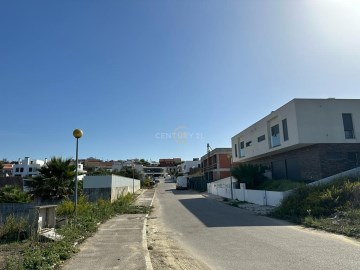
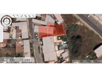
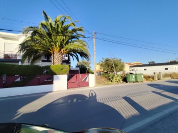
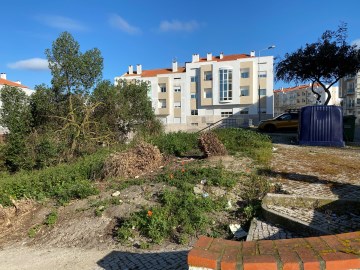
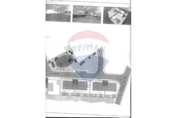
    Plot of land for construction of building in Palhais, 6 fires. Inserted in a plot of land of 180 m2 with a gross construction area of 741.60 m2 Project approved for the construction of Apartments T1 and T2 with parking and collections in Palhais, ready to build, payment licenses, next to Quinta de Santa Teresa, access to A33, Lisbon and accesses also to south A2. Possibility of advance sales. Charneca da Caparica is one of the most sought after parishes of the municipality of Almada to buy a house, divided into several areas and urbanizations such as: Quinta de Santa Teresa, Quinta Texugo, Botequim, Quinta Santa Maria, Palhais, Quinta da Regateira, Vale Cavala, Quintinhas, Vale rosal among others. All have quick access to the A33 and the IC20 that makes the connections to Lisbon, served by public transport TST, and a few minutes from the best beaches on the south bank (Costa da Caparica and Fonte da Telha). We find all kinds of commerce and services on its main road from the Famous Tremoceira, easter pastry, mainland supermarket and Mini Price, municipal market, McDonald's, among many other services. If you want to delight or have tea you can do so at the Bombonera pastry shop. We can count on several public and private schools. We take care of your financing at no additional cost, work daily with all banks to ensure the best housing credit solution for you. For more information contact: Pedro Silva SCI Real Estate #ref:8776
    295.000 €
    30+ days ago supercasa.pt
    View property
    9
    Land in Caparica e Trafaria
    9
    Land in Caparica e Trafaria
    10
    Imagem 744
    20
    Warehouse
    17
    Land in Charneca de Caparica e Sobreda

    Land in Charneca de Caparica e Sobreda

    Charneca de Caparica e Sobreda, Almada, Setúbal
    1,485 m²
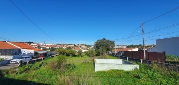
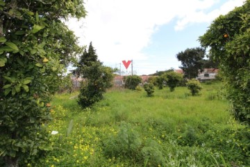
    (ref: (telefone) Terreno para construção. Entrada pela rua da Fraternidade e Rua da Paz em Vale Figueira. Área 1485,16 m2 Área de implantação 445,54 m2 Área bruta de construção 891,09 m2 Contacte-me para marcar a sua visita e conte connosco: - Em todo o processo de compra; - Na procura de um imóvel à medida das suas necessidades; - No acompanhamento negocial; - Na apresentação das mais vantajosas soluções financeiras; - No apoio do processo de financiamento; - Na marcação e realização do Contrato Promessa Compra e Venda; - Na marcação e efetivação da Escritura Pública de Compra e Venda; Espero por si. MISSÃO E VISÃO CENTURY 21 - Com uma cultura de marca fortemente vincada, a C21 e´ guiada pela missa~o de oferecer continuamente uma cultura de servic¸o de excele^ncia ao cliente. Tem como missa~o encontrar e providenciar o melhor servic¸o de mediac¸a~o imobilia´ria, funcionando como uma verdadeira adjuvante e interessada no sucesso dos nego´cios. A dedicac¸a~o, a integridade, a exige^ncia e a especialidade nestas a´reas de atuac¸a~o posiciona-a como parceira de excele^ncia para qualquer nego´cio. A MARCA CENTURY 21 é a maior rede de franchising imobilia´rio do mundo - fundada em 1971 tem mais de 10.000 age^ncias, em 88 pai´ses, com mais de 130 mil agentes em sua representac¸a~o. A marca C21 e´ um dos principais pilares de seriedade, confianc¸a e conhecimento no que concerne a` atividade mobilia´ria. O reconhecimento global do mercado ajuda a C21 a fortalecer a sua posic¸a~o como marca de mediac¸a~o imobilia´ria com o maior sucesso a ni´vel local. #ref:0739-03684
    255.000 €
    299.000 € - 15%
    30+ days ago supercasa.pt
    View property
    3
    1
    18
    IMG_5439

    Garage in Almada, Cova da Piedade, Pragal e Cacilhas

    Almada, Cova da Piedade, Pragal e Cacilhas, Almada, Setúbal
    2 bathrooms
    485 m²
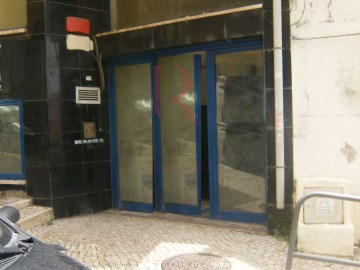
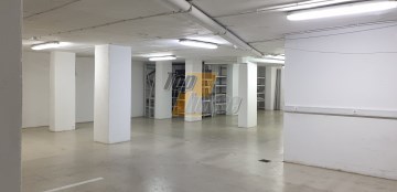
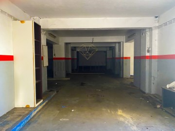
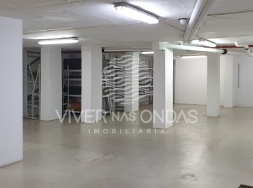
    Almada Garage, 485m2 Garage with excellent areas in the neighborhood of Barrocas in Almada. Great deal! Almada is a Portuguese city located in the Lisbon Metropolitan Area. It has an urban area of 13.98 km2 and 88,202 inhabitants in 2021, hence a population density of 6,309 inhabitants per km2, being the 10th largest city in the country. It is the seat of the municipality of Almada, which has an extension of 70.21 km2 and 177,400 inhabitants in 2021, with a population density of 2,525 inhabitants per km2, divided into five parishes. The municipality is bordered to the east by the municipality of Seixal, to the south by the municipality of Sesimbra, to the west by the Atlantic Ocean and to the north by the Tagus Estuary. The municipality received a charter from Dom Sancho I in 1190. Together with Lisbon, Sintra and Palmela, it is one of the oldest administrative divisions of the Lisbon Metropolitan Area. Almada was elevated to the category of city in 1973, and in its municipality is also the city of Costa da Caparica, whose current status was granted to it in 2004. It has as its main point of interest the National Sanctuary of Christ the King. Geography The municipality of Almada is located in the north-western quadrant of the Setúbal Peninsula. This has as limits, to the north, the Tagus Bottleneck; to the southeast, the municipality of Seixal; and to the south, the municipality of Sesimbra. Its westernmost point is in Cova do Vapor and the easternmost in the Lisbon Naval Base, next to the Corroios Marshland. Cacilhas is the northernmost town of the county, while the southernmost point is in the area of Adiça. The highest point of the county, in the Raposo area, rises in 124.4 m. As for its relief, the municipality is divided into two main areas: the applanation surface (part of the Belverde platform) and the coastal planation. The applanation surface comprises the areas between Trafaria, Almada, Pragal and Caparica up to the ridge line between Sobreda and Charneca, being delimited by the Fossil Cliff of Costa de Caparica and by the escarpments that confront and accompany the Tagus Bottleneck and the municipalities of the north bank of the river (the riverside coasts, one of its main elements of the landscape). In it, the terrain is more undulating to the northeast, moderating its roughness towards the southwest. The quota also decreases to the south and to the interior of the county (where the 60 to 80 m of quota is reached), and this trend is interrupted by the line of summits Lazarim-Capuchos (whose maximum heights are from 90 to 100 m). The source, towards the Sea of Straw, its elevations also descend until they reach maximums of 30 to 40 m. In turn, these escarpments are torn by ditches created by the drainage lines that will flow into the Tagus. The second corresponds to the coastal plain of Costa de Caparica, which does not exceed 11 meters of altimetric level. It has a greater width to the north, gradually constricting towards the south. The east, is bounded longitudinally by the Fossil Cliff of Costa de Caparica, which also decreases in altitude towards meridião. The interstice between the highest areas of the municipality is filled by a depressionary zone marked by the main water lines of the territory of Almada. The highest slopes are found in the two cliffs already mentioned. In the Northern Riverfront (on the slopes of Arealva, Cristo Rei, Banática, Montalvão and Porto do Buxo) the slopes exceed 50%. On the reverse of these, the slopes are moderately abrupt and have slopes between 5% and 16%. Between Cacilhas, Margueira and Cova da Piedade there is a flat strip with slopes of less than 5%, thanks to the alluvial features of the Vala do Caramujo and the embankments built there. The Fossil Cliff has slopes generally greater than 25%, with sections where these exceed 50% and with an almost vertical profile to the north. At its foothills, the coastal plain has a maximum slope of 12%, higher than south of Foz do Rego due to the existence of dunes. The southern part of the coastal platform (Aroeira) has insignificant slopes. To the interior (already on the applanation surface, in a strip between Cacilhas, Pragal, Costas de Cão, Murfacém and Palhais) the slopes present there have slopes of very diverse slopes but ranging from medium to sharp (between 5% and 16%). #ref:8053
    240.000 €
    30+ days ago supercasa.pt
    View property
    12
    Armazém/Garagem_CostadaCaparica
    14
    Terreno_CharnecaCaparica (12)
    18
    IMG_5439

    Garage in Almada, Cova da Piedade, Pragal e Cacilhas

    Almada, Cova da Piedade, Pragal e Cacilhas, Almada, Setúbal
    2 bathrooms
    485 m²
    Almada Garage, 485m2 Garage with excellent areas in the neighborhood of Barrocas in Almada. Great deal! Almada is a Portuguese city located in the Lisbon Metropolitan Area. It has an urban area of 13.98 km2 and 88,202 inhabitants in 2021, hence a population density of 6,309 inhabitants per km2, being the 10th largest city in the country. It is the seat of the municipality of Almada, which has an extension of 70.21 km2 and 177,400 inhabitants in 2021, with a population density of 2,525 inhabitants per km2, divided into five parishes. The municipality is bordered to the east by the municipality of Seixal, to the south by the municipality of Sesimbra, to the west by the Atlantic Ocean and to the north by the Tagus Estuary. The municipality received a charter from Dom Sancho I in 1190. Together with Lisbon, Sintra and Palmela, it is one of the oldest administrative divisions of the Lisbon Metropolitan Area. Almada was elevated to the category of city in 1973, and in its municipality is also the city of Costa da Caparica, whose current status was granted to it in 2004. It has as its main point of interest the National Sanctuary of Christ the King. Geography The municipality of Almada is located in the north-western quadrant of the Setúbal Peninsula. This has as limits, to the north, the Tagus Bottleneck; to the southeast, the municipality of Seixal; and to the south, the municipality of Sesimbra. Its westernmost point is in Cova do Vapor and the easternmost in the Lisbon Naval Base, next to the Corroios Marshland. Cacilhas is the northernmost town of the county, while the southernmost point is in the area of Adiça. The highest point of the county, in the Raposo area, rises in 124.4 m. As for its relief, the municipality is divided into two main areas: the applanation surface (part of the Belverde platform) and the coastal planation. The applanation surface comprises the areas between Trafaria, Almada, Pragal and Caparica up to the ridge line between Sobreda and Charneca, being delimited by the Fossil Cliff of Costa de Caparica and by the escarpments that confront and accompany the Tagus Bottleneck and the municipalities of the north bank of the river (the riverside coasts, one of its main elements of the landscape). In it, the terrain is more undulating to the northeast, moderating its roughness towards the southwest. The quota also decreases to the south and to the interior of the county (where the 60 to 80 m of quota is reached), and this trend is interrupted by the line of summits Lazarim-Capuchos (whose maximum heights are from 90 to 100 m). The source, towards the Sea of Straw, its elevations also descend until they reach maximums of 30 to 40 m. In turn, these escarpments are torn by ditches created by the drainage lines that will flow into the Tagus. The second corresponds to the coastal plain of Costa de Caparica, which does not exceed 11 meters of altimetric level. It has a greater width to the north, gradually constricting towards the south. The east, is bounded longitudinally by the Fossil Cliff of Costa de Caparica, which also decreases in altitude towards meridião. The interstice between the highest areas of the municipality is filled by a depressionary zone marked by the main water lines of the territory of Almada. The highest slopes are found in the two cliffs already mentioned. In the Northern Riverfront (on the slopes of Arealva, Cristo Rei, Banática, Montalvão and Porto do Buxo) the slopes exceed 50%. On the reverse of these, the slopes are moderately abrupt and have slopes between 5% and 16%. Between Cacilhas, Margueira and Cova da Piedade there is a flat strip with slopes of less than 5%, thanks to the alluvial features of the Vala do Caramujo and the embankments built there. The Fossil Cliff has slopes generally greater than 25%, with sections where these exceed 50% and with an almost vertical profile to the north. At its foothills, the coastal plain has a maximum slope of 12%, higher than south of Foz do Rego due to the existence of dunes. The southern part of the coastal platform (Aroeira) has insignificant slopes. To the interior (already on the applanation surface, in a strip between Cacilhas, Pragal, Costas de Cão, Murfacém and Palhais) the slopes present there have slopes of very diverse slopes but ranging from medium to sharp (between 5% and 16%). #ref:8053
    240.000 €
    30+ days ago supercasa.pt
    View property
    20
    Land in Charneca de Caparica e Sobreda
    11
    Loja Centro de Almada | Excelente Investimento | J
    12
    Armazém/Garagem_CostadaCaparica
    3
    1
    9
    Land in Caparica e Trafaria
    11
    Loja Centro de Almada | Excelente Investimento | J
    18
    IMG_5439

    Garage in Almada, Cova da Piedade, Pragal e Cacilhas

    Almada, Cova da Piedade, Pragal e Cacilhas, Almada, Setúbal
    2 bathrooms
    485 m²
    Almada Garage, 485m2 Garage with excellent areas in the neighborhood of Barrocas in Almada. Great deal! Almada is a Portuguese city located in the Lisbon Metropolitan Area. It has an urban area of 13.98 km2 and 88,202 inhabitants in 2021, hence a population density of 6,309 inhabitants per km2, being the 10th largest city in the country. It is the seat of the municipality of Almada, which has an extension of 70.21 km2 and 177,400 inhabitants in 2021, with a population density of 2,525 inhabitants per km2, divided into five parishes. The municipality is bordered to the east by the municipality of Seixal, to the south by the municipality of Sesimbra, to the west by the Atlantic Ocean and to the north by the Tagus Estuary. The municipality received a charter from Dom Sancho I in 1190. Together with Lisbon, Sintra and Palmela, it is one of the oldest administrative divisions of the Lisbon Metropolitan Area. Almada was elevated to the category of city in 1973, and in its municipality is also the city of Costa da Caparica, whose current status was granted to it in 2004. It has as its main point of interest the National Sanctuary of Christ the King. Geography The municipality of Almada is located in the north-western quadrant of the Setúbal Peninsula. This has as limits, to the north, the Tagus Bottleneck; to the southeast, the municipality of Seixal; and to the south, the municipality of Sesimbra. Its westernmost point is in Cova do Vapor and the easternmost in the Lisbon Naval Base, next to the Corroios Marshland. Cacilhas is the northernmost town of the county, while the southernmost point is in the area of Adiça. The highest point of the county, in the Raposo area, rises in 124.4 m. As for its relief, the municipality is divided into two main areas: the applanation surface (part of the Belverde platform) and the coastal planation. The applanation surface comprises the areas between Trafaria, Almada, Pragal and Caparica up to the ridge line between Sobreda and Charneca, being delimited by the Fossil Cliff of Costa de Caparica and by the escarpments that confront and accompany the Tagus Bottleneck and the municipalities of the north bank of the river (the riverside coasts, one of its main elements of the landscape). In it, the terrain is more undulating to the northeast, moderating its roughness towards the southwest. The quota also decreases to the south and to the interior of the county (where the 60 to 80 m of quota is reached), and this trend is interrupted by the line of summits Lazarim-Capuchos (whose maximum heights are from 90 to 100 m). The source, towards the Sea of Straw, its elevations also descend until they reach maximums of 30 to 40 m. In turn, these escarpments are torn by ditches created by the drainage lines that will flow into the Tagus. The second corresponds to the coastal plain of Costa de Caparica, which does not exceed 11 meters of altimetric level. It has a greater width to the north, gradually constricting towards the south. The east, is bounded longitudinally by the Fossil Cliff of Costa de Caparica, which also decreases in altitude towards meridião. The interstice between the highest areas of the municipality is filled by a depressionary zone marked by the main water lines of the territory of Almada. The highest slopes are found in the two cliffs already mentioned. In the Northern Riverfront (on the slopes of Arealva, Cristo Rei, Banática, Montalvão and Porto do Buxo) the slopes exceed 50%. On the reverse of these, the slopes are moderately abrupt and have slopes between 5% and 16%. Between Cacilhas, Margueira and Cova da Piedade there is a flat strip with slopes of less than 5%, thanks to the alluvial features of the Vala do Caramujo and the embankments built there. The Fossil Cliff has slopes generally greater than 25%, with sections where these exceed 50% and with an almost vertical profile to the north. At its foothills, the coastal plain has a maximum slope of 12%, higher than south of Foz do Rego due to the existence of dunes. The southern part of the coastal platform (Aroeira) has insignificant slopes. To the interior (already on the applanation surface, in a strip between Cacilhas, Pragal, Costas de Cão, Murfacém and Palhais) the slopes present there have slopes of very diverse slopes but ranging from medium to sharp (between 5% and 16%). #ref:8053
    240.000 €
    30+ days ago casa.sapo.pt
    View property
    14
    Terreno_CharnecaCaparica (12)
    9
    Land in Caparica e Trafaria
    17
    Land in Charneca de Caparica e Sobreda

    Land in Charneca de Caparica e Sobreda

    Charneca de Caparica e Sobreda, Almada, Setúbal
    1,485 m²
    (ref: (telefone) Terreno para construção. Entrada pela rua da Fraternidade e Rua da Paz em Vale Figueira. Área 1485,16 m2 Área de implantação 445,54 m2 Área bruta de construção 891,09 m2 Contacte-me para marcar a sua visita e conte connosco: - Em todo o processo de compra; - Na procura de um imóvel à medida das suas necessidades; - No acompanhamento negocial; - Na apresentação das mais vantajosas soluções financeiras; - No apoio do processo de financiamento; - Na marcação e realização do Contrato Promessa Compra e Venda; - Na marcação e efetivação da Escritura Pública de Compra e Venda; Espero por si. MISSÃO E VISÃO CENTURY 21 - Com uma cultura de marca fortemente vincada, a C21 e´ guiada pela missa~o de oferecer continuamente uma cultura de servic¸o de excele^ncia ao cliente. Tem como missa~o encontrar e providenciar o melhor servic¸o de mediac¸a~o imobilia´ria, funcionando como uma verdadeira adjuvante e interessada no sucesso dos nego´cios. A dedicac¸a~o, a integridade, a exige^ncia e a especialidade nestas a´reas de atuac¸a~o posiciona-a como parceira de excele^ncia para qualquer nego´cio. A MARCA CENTURY 21 é a maior rede de franchising imobilia´rio do mundo - fundada em 1971 tem mais de 10.000 age^ncias, em 88 pai´ses, com mais de 130 mil agentes em sua representac¸a~o. A marca C21 e´ um dos principais pilares de seriedade, confianc¸a e conhecimento no que concerne a` atividade mobilia´ria. O reconhecimento global do mercado ajuda a C21 a fortalecer a sua posic¸a~o como marca de mediac¸a~o imobilia´ria com o maior sucesso a ni´vel local. #ref:0739-03684
    255.000 €
    299.000 € - 15%
    30+ days ago casa.sapo.pt
    View property
    9
    Land in Charneca de Caparica e Sobreda
    18
    IMG_5439

    Garage in Almada, Cova da Piedade, Pragal e Cacilhas

    Almada, Cova da Piedade, Pragal e Cacilhas, Almada, Setúbal
    2 bathrooms
    485 m²
    Almada Garage, 485m2 Garage with excellent areas in the neighborhood of Barrocas in Almada. Great deal! Almada is a Portuguese city located in the Lisbon Metropolitan Area. It has an urban area of 13.98 km2 and 88,202 inhabitants in 2021, hence a population density of 6,309 inhabitants per km2, being the 10th largest city in the country. It is the seat of the municipality of Almada, which has an extension of 70.21 km2 and 177,400 inhabitants in 2021, with a population density of 2,525 inhabitants per km2, divided into five parishes. The municipality is bordered to the east by the municipality of Seixal, to the south by the municipality of Sesimbra, to the west by the Atlantic Ocean and to the north by the Tagus Estuary. The municipality received a charter from Dom Sancho I in 1190. Together with Lisbon, Sintra and Palmela, it is one of the oldest administrative divisions of the Lisbon Metropolitan Area. Almada was elevated to the category of city in 1973, and in its municipality is also the city of Costa da Caparica, whose current status was granted to it in 2004. It has as its main point of interest the National Sanctuary of Christ the King. Geography The municipality of Almada is located in the north-western quadrant of the Setúbal Peninsula. This has as limits, to the north, the Tagus Bottleneck; to the southeast, the municipality of Seixal; and to the south, the municipality of Sesimbra. Its westernmost point is in Cova do Vapor and the easternmost in the Lisbon Naval Base, next to the Corroios Marshland. Cacilhas is the northernmost town of the county, while the southernmost point is in the area of Adiça. The highest point of the county, in the Raposo area, rises in 124.4 m. As for its relief, the municipality is divided into two main areas: the applanation surface (part of the Belverde platform) and the coastal planation. The applanation surface comprises the areas between Trafaria, Almada, Pragal and Caparica up to the ridge line between Sobreda and Charneca, being delimited by the Fossil Cliff of Costa de Caparica and by the escarpments that confront and accompany the Tagus Bottleneck and the municipalities of the north bank of the river (the riverside coasts, one of its main elements of the landscape). In it, the terrain is more undulating to the northeast, moderating its roughness towards the southwest. The quota also decreases to the south and to the interior of the county (where the 60 to 80 m of quota is reached), and this trend is interrupted by the line of summits Lazarim-Capuchos (whose maximum heights are from 90 to 100 m). The source, towards the Sea of Straw, its elevations also descend until they reach maximums of 30 to 40 m. In turn, these escarpments are torn by ditches created by the drainage lines that will flow into the Tagus. The second corresponds to the coastal plain of Costa de Caparica, which does not exceed 11 meters of altimetric level. It has a greater width to the north, gradually constricting towards the south. The east, is bounded longitudinally by the Fossil Cliff of Costa de Caparica, which also decreases in altitude towards meridião. The interstice between the highest areas of the municipality is filled by a depressionary zone marked by the main water lines of the territory of Almada. The highest slopes are found in the two cliffs already mentioned. In the Northern Riverfront (on the slopes of Arealva, Cristo Rei, Banática, Montalvão and Porto do Buxo) the slopes exceed 50%. On the reverse of these, the slopes are moderately abrupt and have slopes between 5% and 16%. Between Cacilhas, Margueira and Cova da Piedade there is a flat strip with slopes of less than 5%, thanks to the alluvial features of the Vala do Caramujo and the embankments built there. The Fossil Cliff has slopes generally greater than 25%, with sections where these exceed 50% and with an almost vertical profile to the north. At its foothills, the coastal plain has a maximum slope of 12%, higher than south of Foz do Rego due to the existence of dunes. The southern part of the coastal platform (Aroeira) has insignificant slopes. To the interior (already on the applanation surface, in a strip between Cacilhas, Pragal, Costas de Cão, Murfacém and Palhais) the slopes present there have slopes of very diverse slopes but ranging from medium to sharp (between 5% and 16%). #ref:8053
    240.000 €
    30+ days ago casa.sapo.pt
    View property
    22
    Terreno_Palhais

    Land in Charneca de Caparica e Sobreda

    Charneca de Caparica e Sobreda, Almada, Setúbal
    180 m²
    Plot of land for construction of building in Palhais, 6 fires. Inserted in a plot of land of 180 m2 with a gross construction area of 741.60 m2 Project approved for the construction of Apartments T1 and T2 with parking and collections in Palhais, ready to build, payment licenses, next to Quinta de Santa Teresa, access to A33, Lisbon and accesses also to south A2. Possibility of advance sales. Charneca da Caparica is one of the most sought after parishes of the municipality of Almada to buy a house, divided into several areas and urbanizations such as: Quinta de Santa Teresa, Quinta Texugo, Botequim, Quinta Santa Maria, Palhais, Quinta da Regateira, Vale Cavala, Quintinhas, Vale rosal among others. All have quick access to the A33 and the IC20 that makes the connections to Lisbon, served by public transport TST, and a few minutes from the best beaches on the south bank (Costa da Caparica and Fonte da Telha). We find all kinds of commerce and services on its main road from the Famous Tremoceira, easter pastry, mainland supermarket and Mini Price, municipal market, McDonald's, among many other services. If you want to delight or have tea you can do so at the Bombonera pastry shop. We can count on several public and private schools. We take care of your financing at no additional cost, work daily with all banks to ensure the best housing credit solution for you. For more information contact: Pedro Silva SCI Real Estate #ref:8776
    295.000 €
    30+ days ago casa.sapo.pt
    View property
    3
    Industrial building / warehouse in Laranjeiro e Feijó
    pixel