Write a location to search
    Close
    Advertise Favorites
    Login
    Filter
    Filter
    Close
    Order
    For
    Buy
    Rent
    Price
    Bedrooms
    0 0
    1 1
    2 2
    3 3
    4+ 4 or +
    Area
    Features
    Publication Date

    34 Realestates for sale of 225.000 € until 2.300.000 €, in Almada, Cova da Piedade, Pragal e Cacilhas, Almada, Setúbal

    11
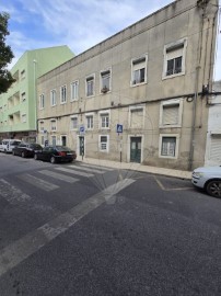
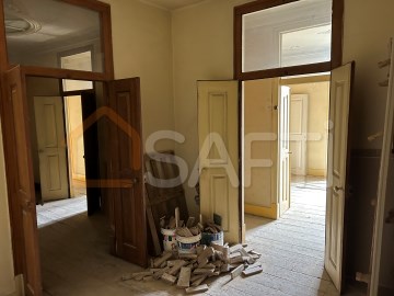
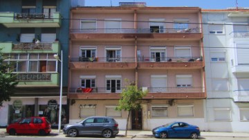
    PREDIO COM 4 APARTAMENTO T3 EM CACILHAS / ALMADA
    29
    Industrial building / warehouse in Almada, Cova da Piedade, Pragal e Cacilhas

    Industrial building / warehouse in Almada, Cova da Piedade, Pragal e Cacilhas

    Almada, Cova da Piedade, Pragal e Cacilhas, Almada, Setúbal
    500 m²
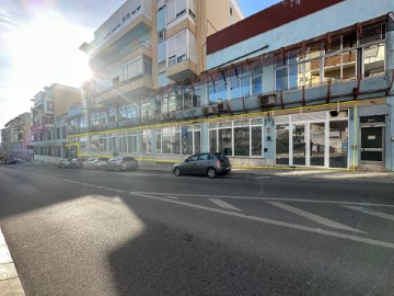
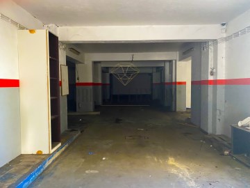
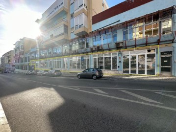
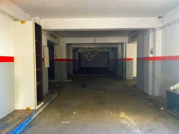
    (ref:C (telefone) Loja / Escritório - Almada - Elegivel para Golden Visa Apresentamos espaço de 500m2, localizado no centro de Almada, elegível para o programa Golden Visa. Localizado na Rua Dom Sancho I, uma das principais ruas da cidade, com grande passagem pedestre e de veículos motorizados, tornando a ampla fachada particularmente interessante para promover qualquer negócio. Possibilidades de atividades: - Loja , aproveitando a enorme montra para exposição ; - Indústria em que seja necessário um espaço central para mobilidade dos trabalhadores e comodidade de clientes; - Escritório ou espaço de Cowork, com a possibilidade de ter espaços comuns e gabinetes com luz/ vista para a rua; - Clinica médica ou hospital veterinário; - Armazém para logística / assistência a clientes; - Parque de atividades para crianças; Teve em 2022, uma obra de remodelação iniciada, estando cerca de 80% completa, com a colocação de: - Caixilharia de alumínio lacado de branco e vidro duplo; - Soalho flutuante; - Teto falso; - Pré-instalação de ar condicionado; - 2 Casas de banho; - Copa completamente equipada; Embora seja vendido no estado atual, apresentamos no anúncio, as fotos do imóvel como está atualmente e como foi projetado para observar o potencial do imóvel, podendo proceder aos últimos acabamentos a gosto. A nível de mobilidade tem várias carreiras de autocarros a passar na rua, com ligação ao Cais do Ginjal, para quem vai para Lisboa através dos Cacilheiros, fazendo depois a ligação ao metro ou comboio. Tem nas proximidades também autocarros para o centro Sul e Pragal, podendo aí ter acesso aos comboios da Fertagus. Área, luminosidade, centralidade e valor m2 competitivo, este imóvel tem tudo, venha conhecê-lo e aqui instalar a sua empresa. #ref:C0223-05434
    620.000 €
    30+ days ago supercasa.pt
    View property
    12
    Building in Almada, Cova da Piedade, Pragal e Cacilhas
    18
    IMG_5439

    Garage in Almada, Cova da Piedade, Pragal e Cacilhas

    Almada, Cova da Piedade, Pragal e Cacilhas, Almada, Setúbal
    2 bathrooms
    485 m²
    Almada Garage, 485m2 Garage with excellent areas in the neighborhood of Barrocas in Almada. Great deal! Almada is a Portuguese city located in the Lisbon Metropolitan Area. It has an urban area of 13.98 km2 and 88,202 inhabitants in 2021, hence a population density of 6,309 inhabitants per km2, being the 10th largest city in the country. It is the seat of the municipality of Almada, which has an extension of 70.21 km2 and 177,400 inhabitants in 2021, with a population density of 2,525 inhabitants per km2, divided into five parishes. The municipality is bordered to the east by the municipality of Seixal, to the south by the municipality of Sesimbra, to the west by the Atlantic Ocean and to the north by the Tagus Estuary. The municipality received a charter from Dom Sancho I in 1190. Together with Lisbon, Sintra and Palmela, it is one of the oldest administrative divisions of the Lisbon Metropolitan Area. Almada was elevated to the category of city in 1973, and in its municipality is also the city of Costa da Caparica, whose current status was granted to it in 2004. It has as its main point of interest the National Sanctuary of Christ the King. Geography The municipality of Almada is located in the north-western quadrant of the Setúbal Peninsula. This has as limits, to the north, the Tagus Bottleneck; to the southeast, the municipality of Seixal; and to the south, the municipality of Sesimbra. Its westernmost point is in Cova do Vapor and the easternmost in the Lisbon Naval Base, next to the Corroios Marshland. Cacilhas is the northernmost town of the county, while the southernmost point is in the area of Adiça. The highest point of the county, in the Raposo area, rises in 124.4 m. As for its relief, the municipality is divided into two main areas: the applanation surface (part of the Belverde platform) and the coastal planation. The applanation surface comprises the areas between Trafaria, Almada, Pragal and Caparica up to the ridge line between Sobreda and Charneca, being delimited by the Fossil Cliff of Costa de Caparica and by the escarpments that confront and accompany the Tagus Bottleneck and the municipalities of the north bank of the river (the riverside coasts, one of its main elements of the landscape). In it, the terrain is more undulating to the northeast, moderating its roughness towards the southwest. The quota also decreases to the south and to the interior of the county (where the 60 to 80 m of quota is reached), and this trend is interrupted by the line of summits Lazarim-Capuchos (whose maximum heights are from 90 to 100 m). The source, towards the Sea of Straw, its elevations also descend until they reach maximums of 30 to 40 m. In turn, these escarpments are torn by ditches created by the drainage lines that will flow into the Tagus. The second corresponds to the coastal plain of Costa de Caparica, which does not exceed 11 meters of altimetric level. It has a greater width to the north, gradually constricting towards the south. The east, is bounded longitudinally by the Fossil Cliff of Costa de Caparica, which also decreases in altitude towards meridião. The interstice between the highest areas of the municipality is filled by a depressionary zone marked by the main water lines of the territory of Almada. The highest slopes are found in the two cliffs already mentioned. In the Northern Riverfront (on the slopes of Arealva, Cristo Rei, Banática, Montalvão and Porto do Buxo) the slopes exceed 50%. On the reverse of these, the slopes are moderately abrupt and have slopes between 5% and 16%. Between Cacilhas, Margueira and Cova da Piedade there is a flat strip with slopes of less than 5%, thanks to the alluvial features of the Vala do Caramujo and the embankments built there. The Fossil Cliff has slopes generally greater than 25%, with sections where these exceed 50% and with an almost vertical profile to the north. At its foothills, the coastal plain has a maximum slope of 12%, higher than south of Foz do Rego due to the existence of dunes. The southern part of the coastal platform (Aroeira) has insignificant slopes. To the interior (already on the applanation surface, in a strip between Cacilhas, Pragal, Costas de Cão, Murfacém and Palhais) the slopes present there have slopes of very diverse slopes but ranging from medium to sharp (between 5% and 16%). #ref:8053
    240.000 €
    30+ days ago supercasa.pt
    View property
    12
    Building in Almada, Cova da Piedade, Pragal e Cacilhas
    48
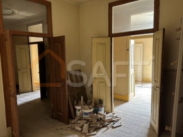
    Predio por remodelar em Cacilhas com 543,2m2
    18
    IMG_5439

    Garage in Almada, Cova da Piedade, Pragal e Cacilhas

    Almada, Cova da Piedade, Pragal e Cacilhas, Almada, Setúbal
    2 bathrooms
    485 m²
    Almada Garage, 485m2 Garage with excellent areas in the neighborhood of Barrocas in Almada. Great deal! Almada is a Portuguese city located in the Lisbon Metropolitan Area. It has an urban area of 13.98 km2 and 88,202 inhabitants in 2021, hence a population density of 6,309 inhabitants per km2, being the 10th largest city in the country. It is the seat of the municipality of Almada, which has an extension of 70.21 km2 and 177,400 inhabitants in 2021, with a population density of 2,525 inhabitants per km2, divided into five parishes. The municipality is bordered to the east by the municipality of Seixal, to the south by the municipality of Sesimbra, to the west by the Atlantic Ocean and to the north by the Tagus Estuary. The municipality received a charter from Dom Sancho I in 1190. Together with Lisbon, Sintra and Palmela, it is one of the oldest administrative divisions of the Lisbon Metropolitan Area. Almada was elevated to the category of city in 1973, and in its municipality is also the city of Costa da Caparica, whose current status was granted to it in 2004. It has as its main point of interest the National Sanctuary of Christ the King. Geography The municipality of Almada is located in the north-western quadrant of the Setúbal Peninsula. This has as limits, to the north, the Tagus Bottleneck; to the southeast, the municipality of Seixal; and to the south, the municipality of Sesimbra. Its westernmost point is in Cova do Vapor and the easternmost in the Lisbon Naval Base, next to the Corroios Marshland. Cacilhas is the northernmost town of the county, while the southernmost point is in the area of Adiça. The highest point of the county, in the Raposo area, rises in 124.4 m. As for its relief, the municipality is divided into two main areas: the applanation surface (part of the Belverde platform) and the coastal planation. The applanation surface comprises the areas between Trafaria, Almada, Pragal and Caparica up to the ridge line between Sobreda and Charneca, being delimited by the Fossil Cliff of Costa de Caparica and by the escarpments that confront and accompany the Tagus Bottleneck and the municipalities of the north bank of the river (the riverside coasts, one of its main elements of the landscape). In it, the terrain is more undulating to the northeast, moderating its roughness towards the southwest. The quota also decreases to the south and to the interior of the county (where the 60 to 80 m of quota is reached), and this trend is interrupted by the line of summits Lazarim-Capuchos (whose maximum heights are from 90 to 100 m). The source, towards the Sea of Straw, its elevations also descend until they reach maximums of 30 to 40 m. In turn, these escarpments are torn by ditches created by the drainage lines that will flow into the Tagus. The second corresponds to the coastal plain of Costa de Caparica, which does not exceed 11 meters of altimetric level. It has a greater width to the north, gradually constricting towards the south. The east, is bounded longitudinally by the Fossil Cliff of Costa de Caparica, which also decreases in altitude towards meridião. The interstice between the highest areas of the municipality is filled by a depressionary zone marked by the main water lines of the territory of Almada. The highest slopes are found in the two cliffs already mentioned. In the Northern Riverfront (on the slopes of Arealva, Cristo Rei, Banática, Montalvão and Porto do Buxo) the slopes exceed 50%. On the reverse of these, the slopes are moderately abrupt and have slopes between 5% and 16%. Between Cacilhas, Margueira and Cova da Piedade there is a flat strip with slopes of less than 5%, thanks to the alluvial features of the Vala do Caramujo and the embankments built there. The Fossil Cliff has slopes generally greater than 25%, with sections where these exceed 50% and with an almost vertical profile to the north. At its foothills, the coastal plain has a maximum slope of 12%, higher than south of Foz do Rego due to the existence of dunes. The southern part of the coastal platform (Aroeira) has insignificant slopes. To the interior (already on the applanation surface, in a strip between Cacilhas, Pragal, Costas de Cão, Murfacém and Palhais) the slopes present there have slopes of very diverse slopes but ranging from medium to sharp (between 5% and 16%). #ref:8053
    240.000 €
    30+ days ago supercasa.pt
    View property
    10
    Fachada do prédio

    Building in Almada, Cova da Piedade, Pragal e Cacilhas

    Almada, Cova da Piedade, Pragal e Cacilhas, Almada, Setúbal
    432 m²
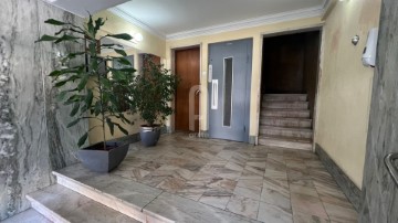
    Located in the center of Almada, at Avenida Dom Nuno Álvares Pereira n.º 40, this building in total property with 8 fractions, has all the apartments of typology T2, with gross private area of 60 m2. The apartments have balconies facing the avenue and the praceta. The current monthly income is € 4,051.00, annual € 48,612.00. 6 fractions are leased, only 1 fraction has an old contract (rent in the amount of 201,00€) 1 fraction is being refurbished 1 fraction is vacant and in need of works Building with license of use issued by the Municipal Chamber of Almada in September 1956 The ground floor has backyards in the evening, with pedestrian access gate to Praceta Dona Leonor Mascarelhas. Located in a central of the city of Almada, it allows pedestrian access and all kinds of services and shops. It is only a few meters from the surface metro stop that gives access to all kinds of transport allowing you to reach Lisbon, Costa da Caprica or Setúbal easily. If you are an investor looking for a safe investment with enormous potential contact us: (phone hidden) (phone hidden) (phone hidden) S. João Batista metro stop - 250 m Bus stop - 250 m Pragal Train Station - 3 km Cacilhas River Station - 1.8 km (25 minutes walk) Almada Health Center - 1 km Nuno Álvares Pharmacy - 150 m Easter Pastry - 40 m Almada Town Hall - 1.5 km / 1.1 mi Joaquim Benite Municipal Theatre - 750 m St. John the Baptist Square - 300 m Piaget Institute - 2.5 km Faculty of Science and Technology - 4.5 m Beaches of Costa da Caparica - 9 km Almada Forum - 3.3 km 25 de Abril Bridge - 4 km #ref:CB07-PRD_12
    1.500.000 €
    30+ days ago casa.sapo.pt
    View property
    12
    Building in Almada, Cova da Piedade, Pragal e Cacilhas
    11
    PREDIO COM 4 APARTAMENTO T3 EM CACILHAS / ALMADA
    18
    IMG_5439

    Garage in Almada, Cova da Piedade, Pragal e Cacilhas

    Almada, Cova da Piedade, Pragal e Cacilhas, Almada, Setúbal
    2 bathrooms
    485 m²
    Almada Garage, 485m2 Garage with excellent areas in the neighborhood of Barrocas in Almada. Great deal! Almada is a Portuguese city located in the Lisbon Metropolitan Area. It has an urban area of 13.98 km2 and 88,202 inhabitants in 2021, hence a population density of 6,309 inhabitants per km2, being the 10th largest city in the country. It is the seat of the municipality of Almada, which has an extension of 70.21 km2 and 177,400 inhabitants in 2021, with a population density of 2,525 inhabitants per km2, divided into five parishes. The municipality is bordered to the east by the municipality of Seixal, to the south by the municipality of Sesimbra, to the west by the Atlantic Ocean and to the north by the Tagus Estuary. The municipality received a charter from Dom Sancho I in 1190. Together with Lisbon, Sintra and Palmela, it is one of the oldest administrative divisions of the Lisbon Metropolitan Area. Almada was elevated to the category of city in 1973, and in its municipality is also the city of Costa da Caparica, whose current status was granted to it in 2004. It has as its main point of interest the National Sanctuary of Christ the King. Geography The municipality of Almada is located in the north-western quadrant of the Setúbal Peninsula. This has as limits, to the north, the Tagus Bottleneck; to the southeast, the municipality of Seixal; and to the south, the municipality of Sesimbra. Its westernmost point is in Cova do Vapor and the easternmost in the Lisbon Naval Base, next to the Corroios Marshland. Cacilhas is the northernmost town of the county, while the southernmost point is in the area of Adiça. The highest point of the county, in the Raposo area, rises in 124.4 m. As for its relief, the municipality is divided into two main areas: the applanation surface (part of the Belverde platform) and the coastal planation. The applanation surface comprises the areas between Trafaria, Almada, Pragal and Caparica up to the ridge line between Sobreda and Charneca, being delimited by the Fossil Cliff of Costa de Caparica and by the escarpments that confront and accompany the Tagus Bottleneck and the municipalities of the north bank of the river (the riverside coasts, one of its main elements of the landscape). In it, the terrain is more undulating to the northeast, moderating its roughness towards the southwest. The quota also decreases to the south and to the interior of the county (where the 60 to 80 m of quota is reached), and this trend is interrupted by the line of summits Lazarim-Capuchos (whose maximum heights are from 90 to 100 m). The source, towards the Sea of Straw, its elevations also descend until they reach maximums of 30 to 40 m. In turn, these escarpments are torn by ditches created by the drainage lines that will flow into the Tagus. The second corresponds to the coastal plain of Costa de Caparica, which does not exceed 11 meters of altimetric level. It has a greater width to the north, gradually constricting towards the south. The east, is bounded longitudinally by the Fossil Cliff of Costa de Caparica, which also decreases in altitude towards meridião. The interstice between the highest areas of the municipality is filled by a depressionary zone marked by the main water lines of the territory of Almada. The highest slopes are found in the two cliffs already mentioned. In the Northern Riverfront (on the slopes of Arealva, Cristo Rei, Banática, Montalvão and Porto do Buxo) the slopes exceed 50%. On the reverse of these, the slopes are moderately abrupt and have slopes between 5% and 16%. Between Cacilhas, Margueira and Cova da Piedade there is a flat strip with slopes of less than 5%, thanks to the alluvial features of the Vala do Caramujo and the embankments built there. The Fossil Cliff has slopes generally greater than 25%, with sections where these exceed 50% and with an almost vertical profile to the north. At its foothills, the coastal plain has a maximum slope of 12%, higher than south of Foz do Rego due to the existence of dunes. The southern part of the coastal platform (Aroeira) has insignificant slopes. To the interior (already on the applanation surface, in a strip between Cacilhas, Pragal, Costas de Cão, Murfacém and Palhais) the slopes present there have slopes of very diverse slopes but ranging from medium to sharp (between 5% and 16%). #ref:8053
    240.000 €
    30+ days ago casa.sapo.pt
    View property
    48
    Predio por remodelar em Cacilhas com 543,2m2
    12
    Building in Almada, Cova da Piedade, Pragal e Cacilhas
    15
    Building in Almada, Cova da Piedade, Pragal e Cacilhas
    15
    Commercial premises in Almada, Cova da Piedade, Pragal e Cacilhas

    Commercial premises in Almada, Cova da Piedade, Pragal e Cacilhas

    Almada, Cova da Piedade, Pragal e Cacilhas, Almada, Setúbal
    450 m²
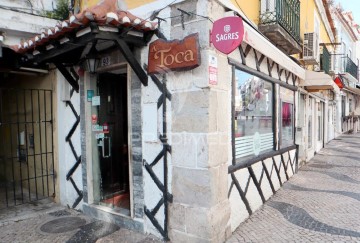
    Está à procura de uma oportunidade única no setor da restauração? Apresentamos-lhe um restaurante de renome, situado no coração de Cacilhas, na prestigiada Rua Cândido Reis, a zona pedonal mais 'cool' de Almada, onde lazer, cultura, arte e boa comida se cruzam. --- Características --- Tipo de Cozinha: Comida alentejana, grelhados e marisco. Localização: Cacilhas, Almada – uma localização privilegiada que atrai tanto residentes como turistas. Capacidade: 130 lugares no interior e 100 no exterior, proporcionando um ambiente confortável e acolhedor para todos os clientes. Tem a maior esplanada desta rua turística. Reconhecimento: O Restaurante A Toca conta com mais de 40 anos de experiência no ramo, tendo sido premiado inúmeras vezes pelos críticos de gastronomia. Um dos melhores restaurantes da zona, amplamente reconhecido na cidade de Almada e muito procurado por clientes locais e estrangeiros. Espaços Adicionais O trespasse também inclui: 1 - Café: situado em frente ao restaurante, que pode ser utilizado como bar/café ou para expandir a capacidade do restaurante em épocas de maior afluência. 2 - Armazém: o restaurante conta com um enorme armazém no seu interior, que pode ser repensado para aumentar ainda mais a área de serviço aos clientes. 3 - Loja/garrafeira: com uma seleção de vinhos e licores de extrema qualidade. 4 - Apartamento T1 Esta é uma oportunidade rara para adquirir um negócio estabelecido e próspero, com clientes fiéis e uma localização excepcional. Não perca a oportunidade de continuar a tradição de excelência culinária e hospitalidade deste prestigiado restaurante no coração de Cacilhas! Negócio com excelente margem de lucro. Para mais informações e agendamento de visitas, por favor entre em contacto. #ref:045888
    597.000 €
    22 days ago imovirtual.com
    View property
    8
    Industrial building / warehouse in Almada, Cova da Piedade, Pragal e Cacilhas

    Industrial building / warehouse in Almada, Cova da Piedade, Pragal e Cacilhas

    Almada, Cova da Piedade, Pragal e Cacilhas, Almada, Setúbal
    512 m²
    Armazém para Venda em Almada - 512m² Rua D. João IV 21. Oportunidade única de adquirir um armazém espaçoso e bem localizado em Almada! Características do Imóvel: Área Total: 512m² Localização: Almada, em uma zona estratégica com fácil acesso às principais vias da região. Espaço Interno: Amplos espaços abertos, ideal para armazenamento, logística ou pequenas indústrias. Condições do Imóvel: Em excelente estado de conservação, pronto para uso imediato. Instalações: Área administrativa, casa de banho, sistema elétrico e de iluminação, e espaço caixa forte com porta adequada alta segurança. Muita luz natural. Estacionamento: Espaço para estacionamento de veículos na área interna e externa. Vantagens: Acessibilidade: Próximo a transportes públicos e com fácil acesso a autoestradas, facilitando o transporte e distribuição de mercadorias. Segurança: Local seguro com estrutura reforçada, garantindo a proteção dos bens armazenados, portão automático e alarme Versatilidade: Adequado para diversas finalidades, incluindo armazenamento, centro de distribuição, pequenas fábricas ou outras atividades comerciais. Não perca esta oportunidade de expandir o seu negócio com um armazém de alta qualidade em uma localização privilegiada. Para mais informações ou para agendar uma visita, entre em contato: #ref:C0364-03471
    490.000 €
    28 days ago imovirtual.com
    View property
    15
    Industrial building / warehouse in Almada, Cova da Piedade, Pragal e Cacilhas

    Industrial building / warehouse in Almada, Cova da Piedade, Pragal e Cacilhas

    Almada, Cova da Piedade, Pragal e Cacilhas, Almada, Setúbal
    500 m²
    Loja / Escritório - Almada - Elegivel para Golden Visa Apresentamos espaço de 500m2, localizado no centro de Almada, elegível para o programa Golden Visa. Localizado na Rua Dom Sancho I, uma das principais ruas da cidade, com grande passagem pedestre e de veículos motorizados, tornando a ampla fachada particularmente interessante para promover qualquer negócio. Possibilidades de atividades: - Loja , aproveitando a enorme montra para exposição ; - Indústria em que seja necessário um espaço central para mobilidade dos trabalhadores e comodidade de clientes; - Escritório ou espaço de Cowork, com a possibilidade de ter espaços comuns e gabinetes com luz/ vista para a rua; - Clinica médica ou hospital veterinário; - Armazém para logística / assistência a clientes; - Parque de atividades para crianças; Teve em 2022, uma obra de remodelação iniciada, estando cerca de 80% completa, com a colocação de: - Caixilharia de alumínio lacado de branco e vidro duplo; - Soalho flutuante; - Teto falso; - Pré-instalação de ar condicionado; - 2 Casas de banho; - Copa completamente equipada; Embora seja vendido no estado atual, apresentamos no anúncio, as fotos do imóvel como está atualmente e como foi projetado para observar o potencial do imóvel, podendo proceder aos últimos acabamentos a gosto. A nível de mobilidade tem várias carreiras de autocarros a passar na rua, com ligação ao Cais do Ginjal, para quem vai para Lisboa através dos Cacilheiros, fazendo depois a ligação ao metro ou comboio. Tem nas proximidades também autocarros para o centro Sul e Pragal, podendo aí ter acesso aos comboios da Fertagus. Área, luminosidade, centralidade e valor m2 competitivo, este imóvel tem tudo, venha conhecê-lo e aqui instalar a sua empresa. (ref:C0223-05434) #ref:15935926
    620.000 €
    30+ days ago bpiexpressoimobiliario.pt
    View property
    15
    Building in Almada, Cova da Piedade, Pragal e Cacilhas
    48
    Predio por remodelar em Cacilhas com 543,2m2
    15
    Garage in Almada, Cova da Piedade, Pragal e Cacilhas

    Garage in Almada, Cova da Piedade, Pragal e Cacilhas

    Almada, Cova da Piedade, Pragal e Cacilhas, Almada, Setúbal
    2 bathrooms
    485 m²
    Garagem Almada, 485m2 Garagem com excelentes áreas no bairro das Barrocas em Almada. Ótimo negocio! Almada é uma cidade portuguesa localizada na Área Metropolitana de Lisboa. Tem uma área urbana de 13,98 km2 e 88.202 habitantes em 2021, donde uma densidade populacional de 6.309 habitantes por km2, sendo a 10 maior cidade do país. É sede do município de Almada, que tem uma extensão de 70,21 km2 e 177.400 habitantes em 2021, com uma densidade populacional de 2.525 habitantes por km2, dividindo-se em cinco freguesias. O município é limitado a leste pelo município do Seixal, a sul pelo município de Sesimbra, a oeste pelo Oceano Atlântico e a norte pelo Estuário do Tejo. O município recebeu foral de Dom Sancho I em 1190. Juntamente com Lisboa, Sintra e Palmela, é uma das mais antigas divisões administrativas da Área Metropolitana de Lisboa. Almada foi elevada à categoria de cidade em 1973, e no seu município encontra-se também a cidade de Costa da Caparica, cujo estatuto atual lhe foi outorgado no ano de 2004. Possui como principal ponto de interesse o Santuário Nacional de Cristo Rei. Geografia O município de Almada encontra-se no quadrante norte-ocidental da Península de Setúbal. Este tem como limites, a norte, o Gargalo do Tejo; a sudeste, o concelho do Seixal; e a sul, o concelho de Sesimbra. O seu ponto mais ocidental encontra-se na Cova do Vapor e o mais oriental na Base Naval de Lisboa, junto ao Sapal de Corroios. Cacilhas é a localidade mais setentrional do concelho, enquanto que o ponto mais meridional se encontra na zona da Adiça. O ponto mais alto do concelho, na zona do Raposo, eleva-se em 124,4 m. Quanto ao seu relevo, o concelho divide-se em duas áreas principais: a superfície de aplanação (parte da plataforma de Belverde) e a aplanação litoral. A superfície de aplanação compreende as zonas entre Trafaria, Almada, Pragal e Caparica até à linha de cumeadas entre a Sobreda e Charneca, sendo delimitada pela Arriba Fóssil da Costa de Caparica e pelas escarpas que confrontam e acompanham o Gargalo do Tejo e os municípios da margem norte do rio (as costeiras ribeirinhas, um dos seus principais elementos da paisagem). Nela, o terreno apresenta-se mais ondulado a nordeste, moderando a sua rugosidade em direção a sudoeste. A cota também decresce para sul e para o interior do concelho (onde se atingem os 60 a 80 m de cota), sendo esta tendência interrompida pela linha de cumeadas Lazarim-Capuchos (cujas alturas máximas são de 90 a 100 m). A nascente, em direção ao Mar da Palha, as suas cotas descem igualmente até atingirem máximos de 30 a 40 m. Por sua vez, estas escarpas são rasgadas por valas criadas pelas linhas de drenagem que vão desaguar no Tejo. A segunda corresponde à planície litoral da Costa de Caparica, que não excede os 11 metros de cota altimétrica. Apresenta maior largura a norte, constringindo-se gradualmente em direção a sul. A nascente, é delimitada longitudinalmente pela Arriba Fóssil da Costa de Caparica, que também dimunui de altitude em direção a meridião. O interstício entre as zonas mais altas do concelho é preenchido por uma zona depressionária marcada pelas principais linhas de água do território de Almada. Os declives mais elevados encontram-se nas duas arribas já mencionadas. Na Frente Ribeirinha Norte (nas vertentes de Arealva, Cristo Rei, Banática, Montalvão e Porto do Buxo) os declives superam os 50%. No reverso destas, as vertentes são medianamente abruptas e apresentam declives entre 5% e 16%. Entre Cacilhas, Margueira e Cova da Piedade surge uma faixa plana com declives inferiores a 5%, graças às aluviões da Vala do Caramujo e aos aterros aí construídos. A Arriba Fóssil possui declives geralmente superiores a 25%, com troços onde estes superam os 50% e com um perfil quase vertical a norte. No seu sopé, a planície costeira apresenta um declive máximo de 12%, superiores a sul da Foz do Rego devido à existência de dunas. A zona sul da plataforma litoral (Aroeira) apresenta declives insignificantes. Para o interior (já na superfície de aplanação, numa faixa entre Cacilhas, Pragal, Costas de Cão, Murfacém e Palhais) as encostas aí presentes possuem pendentes de declives muito diversos mas que variam entre médios a acentuados (entre 5% e 16%). Categoria Energética: Isento #ref:15844900
    240.000 €
    30+ days ago bpiexpressoimobiliario.pt
    View property
    pixel